| dc.contributor.corporatename | University of Missouri | eng |
| dc.contributor.illustrator | Arnhold, Ralph C. | eng |
| dc.coverage.spatial | Missouri -- Columbia | eng |
| dc.coverage.temporal | 1950-1959 | eng |
| dc.date.issued | 1956 | eng |
| dc.description | "Ralph C. Arnhold 1956." | eng |
| dc.description | Reverse of map is blank. | eng |
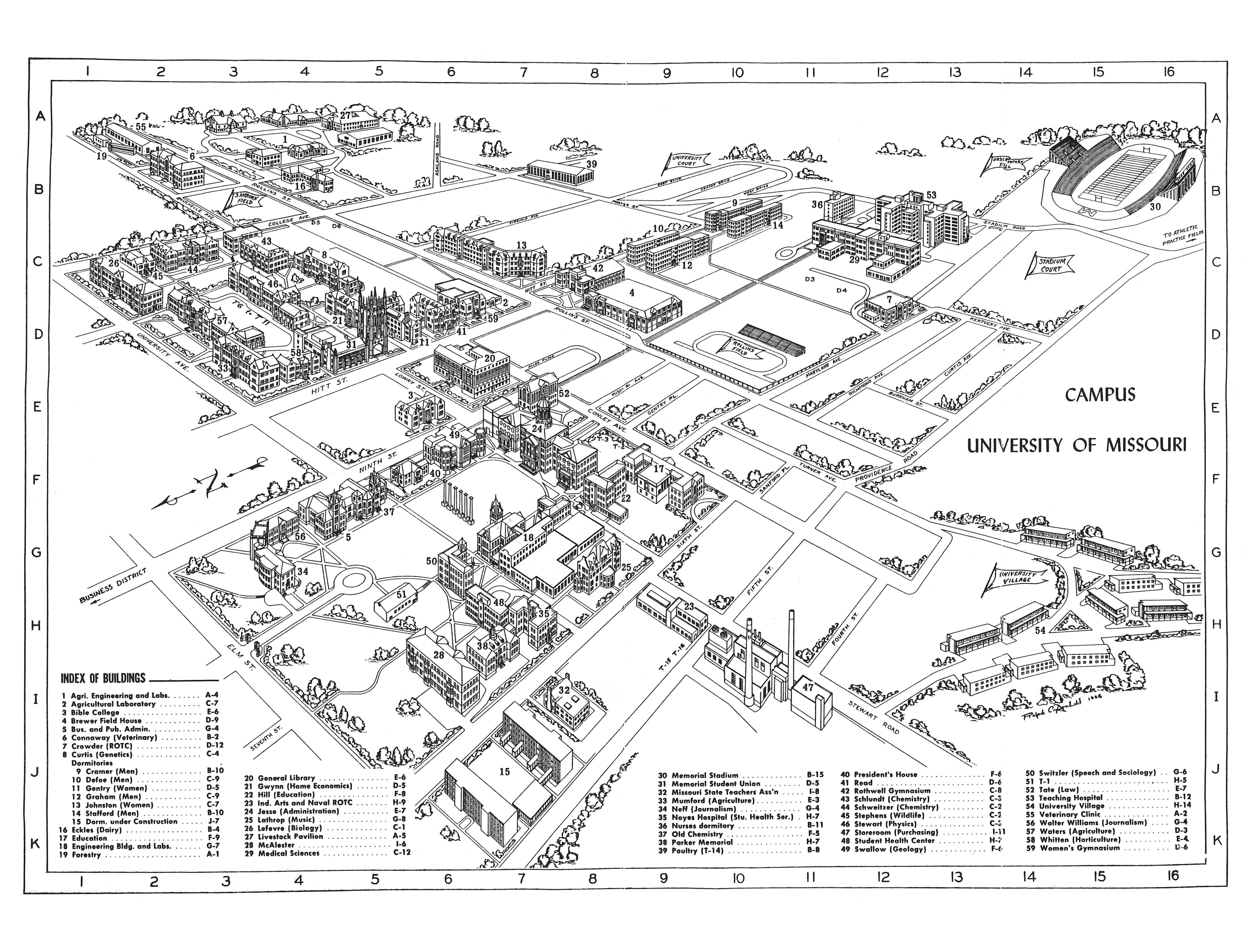
| dc.description | Map issued as part of: Catalog, one hundred fifteenth report of the Curators to the Governor of the State; Announcements for the academic year 1957-58. University of Missouri bulletin ; volume 58, number 17. General series ; 1957, number 09. | eng |
| dc.description.abstract | This map, drawn by Ralph C. Arnhold, shows the locations of buildings via an alphanumeric grid on the University of Missouri campus. | eng |
| dc.format.extent | 1 map | eng |
| dc.identifier.other | Map-0037 (MU Dig ID) | eng |
| dc.identifier.uri | https://hdl.handle.net/10355/57195 | |
| dc.language | English | eng |
| dc.publisher | University of Missouri | eng |
| dc.relation.ispartofcollection | University of Missouri-Columbia. University of Missouri maps | eng |
| dc.source | Digitized by the University Libraries. Item digitized: University Archives, C:0/49/1, OSF#1, Campus Maps Pre-1970. | eng |
| dc.subject.FAST | University of Missouri | eng |
| dc.subject.other | MU maps -- Buildings, structures, etc. | eng |
| dc.subject.other | MU maps -- Pictorial map | eng |
| dc.title | Campus : University of Missouri | eng |
| dc.type | Map | eng |
